
|
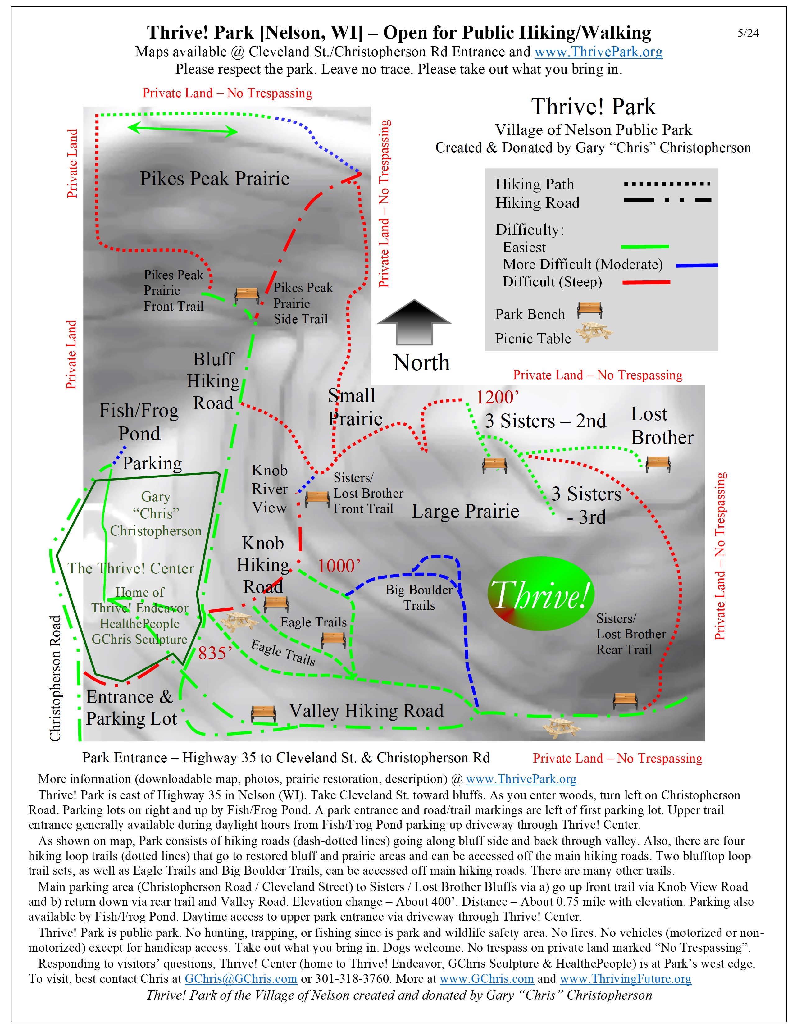
As shown on map, Park consists of hiking roads (dash-dotted lines) going along bluff side and back through valley. Also, there are several hiking trails (dotted lines) that go to restored bluff and prairie areas and can be accessed off the main hiking roads. Two loop trail sets, including Eagle Trail, can be accessed off main hiking roads. Maps available @ Cleveland St./Christopherson Rd Entrance and www.ThrivePark.org Download map at Thrive Park map and description |
 |
 |
Thrive Park |